
The Consumer’s Guide to Buying Diamonds
Never commit the same mistakes that 90% of shoppers make when buying an engagement ring…
Buying a Beautiful Diamond Engagement Ring Doesn’t Have to Be Hard
When it comes to purchasing diamonds online or at a physical store, most people are clueless about the things to look out for and how to protect themselves from making a bad purchase. You can’t really blame them.
The thing is, purchasing a diamond isn’t something you would do on a regular basis unless there’s a special occasion coming up. And like many of you, I had been through the same experience and I understand how it feels to be making a big purchase that is hinged with uncertainty.
Chances are, when you landed on this website, you are probably trying to do your own research or looking for shopping tips before hitting the stores. And that’s what I am going to show you here at Beyond4cs.com.
Before we dive into details, I want you to watch the video below and check out a recently purchased diamond ring. This white gold pave engagement ring features a 0.57 carat super ideal cut diamond with superb brilliance and sparkle.
Does it surprise you to know that this engagement ring has BETTER craftsmanship and diamond quality than those you find at high-end stores like Tiffany or Cartier? On top of that, this diamond ring costs 40-50% less than what you would pay at traditional retail stores (and yes, I’m talking about SAME specs and 4Cs).
So, here’s the thing. Buying a high quality diamond ring isn’t rocket science and you could do it too! If you want to be a smart shopper, you need to understand the essential elements of selecting a good diamond and know what are the critical pitfalls to avoid.
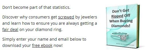
First things first, I’ve prepared a brand new e-book to get you up to speed and it’s available to download for free. Simply enter your name and email below to access your FREE e-book now!
Every Year, There Are Thousands Of Consumers
Who Have Been Ripped Off Unknowingly By Jewelers
100% No Spam. Your Privacy Is Important To Us.
Find Out How to Choose the Best Diamond For Your Budget

So, why is research and education required when shopping for diamonds? Beyond the listed price tags, there are a lot more factors to consider when selecting a diamond. For example, there are a number of reasons why a diamond can be pricier or cheaper when compared to another diamond with similar specifications.
Many times, it is the subtle differences between diamonds that can mean a huge difference in optical performance and appearance. And these are the reasons that you need to understand if you want to make the best possible purchase for a given budget.
In a nutshell, there are 4 main characteristics to look for when you are searching for a diamond. These are; Cut, Clarity, Color and Carat. As a whole, the 4Cs govern the overall quality of a diamond. On a fundamental level, each aspect of the 4Cs can greatly change the price and technical qualities that the stone possesses.
Truth be told, each of these characteristics requires a deeper knowledge than what is usually told to you by a sales assistant. In each of the sections below, you will learn insights that will help you save money and gain knowledge that you can use to your advantage during shopping.
The Four C’s – Insights That They’ll Never Tell You…
Cut

The cut determines how well a diamond absorbs and reflects light. The better the cut, the more sparkle the stone will have. Note: Cut does NOT refer to the shape of the stone.
Clarity

The clarity of a diamond refers to the amount/type of inclusions present in it. A diamond with lesser flaws inspected under 10X magnification receives a higher grade.
Color

The color of a diamond is rated on a scale of D – Z, with D being totally colorless and Z being a noticeable yellow. In the market, the range of D-F is highly sought after.
Carat

The carat weight refers to a specific measurement of how heavy the diamond is. Note: By itself, carat weight is not an indication of the stone’s physical dimensions.
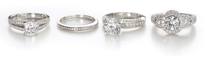
Insider Tips to Selecting Fancy Cut Diamonds
Traditionally, the round brilliant cut has always been the most popular diamond shape due to its versatility and excellent light properties. In more recent times, a larger and more affluent consumer base has fueled the demand for diversity in jewelry choices.
This has resulted in a steady introduction of new cutting styles and also a revival of vintage designs in the market.
If you are interested in getting a fancy shaped diamond, head over to the corresponding sections on Beyond4Cs.com for the relevant information. Bear in mind that the selection process and criteria for each different shape will not the same.
For example, inclusions in an emerald cut are generally easier to detect with the naked eyes as compared to a round diamond due to its intrinsic step cut. Due to this reason, a higher clarity grade is recommended when buying emerald cut diamonds if you don’t want to compromise eye cleanliness.

Click here for more details on the individual shapes…
Once you are armed with the necessary knowledge, you can shop with confidence from anywhere you are comfortable with. Whether you want to shop for your engagement ring locally or online, the choice is really up to you. However, if you want to get a better bang for your buck, my advice to you is to make your purchase online instead of buying from a local brick and mortar store.
For online stores, these are a few places that I highly recommend: James Allen (top choice for fancy cuts) & Brian Gavin (top choice for super ideal hearts and arrows). Whiteflash is another vendor I recommend for super ideal cut diamonds. Besides well-cut stones, they also have a comprehensive portfolio of designer brands like Verragio, Simon G, Ritani, Tacori and more…
The rationale of going online is simple: You’ll avoid paying the expensive overheads that physical stores pass onto you and you don’t get pressured by sales people into making a purchase.
Apart from getting a better deal, online stores offer a HUGE selection of diamonds and this allows you to cherry pick the best possible diamond. In contrast, when shopping in a physical store, you are only limited to a few choices from the store’s available inventory.
4 Things That Consumers Should Know Before They Shop
#1 Knowledge is Power – The majority of consumers have very little or no knowledge about diamonds and usually end up paying twice of what a gemstone is actually worth. Don’t you find it weird that people spend thousands of dollars on a purchase without knowing what makes it a good value?
#2 Avoid the Marketing Gimmicks – High quality diamonds are never on sale. Forget about all the advertisement hypes that constantly scream 50%-75% off. If jewelers can sell top notch inventory for more, what do you think the reasons behind the “massive discounts” are?
#3 Dismal Cut Standards In the Industry – Less than 10% of the diamonds in the market are cut for optimal light brilliance. Instead, the majority of them are cut to maximize the jeweler’s profit margin by retaining “dead weight”.
#4 Going Beyond the 4Cs – Buying based on the 4Cs isn’t enough. Most jewelers would simply repeat and regurgitate to you the same old information without telling you the real insights to choosing the perfect stone.
The fact that you are reading this right now will help you avoid making bad decisions.
Personalized Advice On Buying Your Diamond Engagement Ring
Shopping for a diamond ring can be very stressful especially if you have a tight timeline to work with. However, once you get past the initial phase of doing research, you will know what to look out for and be able to make good purchase decisions.
Remember, a high quality diamond will never be sold at a price below its value and it may take a while before you come across the right gemstone for your needs. Also, everyone has their own tastes.
Some people might prefer a fancy shape over a round cut while others might prefer diamonds with warmer colors over colorless diamonds. So, if you plan on buying a piece of jewelry for someone else, make sure you figure out what they like beforehand.
After all, diamonds are forever. When you make a purchase, you want to make sure you do it once and do it well. You (or your partner) won’t want to be stuck with something that you wouldn’t enjoy wearing and end up with buyer’s remorse.
Lastly, if you need advice in choosing a diamond or require a second opinion on a pending purchase; please feel free to contact me via email. I will usually reply your email within 24 hours.
All the best in your shopping experience!

GIA Diamonds Graduate
paul [@] beyond4cs.com
(To prevent spam, you need to remove the [ ] when you email me)
Comments are closed.
Latest Posts From Our Blog


Join Us On Social Media!


Visit The Gallery For Ideas!

